Sandstone bluffs…Devil’s Elbow…W.H. Croaker. We’ve driven almost all of the Mother Road over the years. I can’t believe we missed exploring Route 66 through Pulaski County, Missouri, especially since we drive through Missouri often. When we finally made it to Pulaski County this summer, we followed the auto tour that the Pulaski County Tourism Bureau laid out in a brochure. The route is filled with natural beauty, remnants of Route 66 treasures, and one quirky road side attraction.
We actually stumbled upon Pulaski County a couple of years ago. We were on our way down to southern Missouri and got off the interstate to take a slower, more leisurely route for a while. Little did we know how slow it would end up being! It happened to be the day of the Waynesville High School homecoming parade, and we got caught by a parade roadblock. We tried going up and down different streets to no avail. But we saw so many interesting things that we knew we had to return.
Don’t miss a Midwest Wanderer post. For a FREE subscription, enter your e-mail address in the Subscribe2 box to the right and click Subscribe.
So return we did. We spent three days in Pulaski County. We kayaked the Gasconade River, played Pitch & Putt golf, and visited nearby Fort Leonard Wood to catch an antique military vehicle convoy that came through town. Then we drove Route 66 from one end of the county to the other. The auto tour begins on Highway Z, the I-44 Exit 169. I’ll let the photos tell the story.
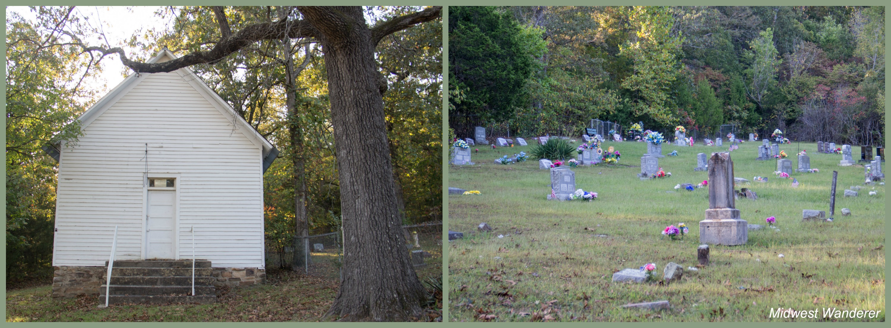
Hooker
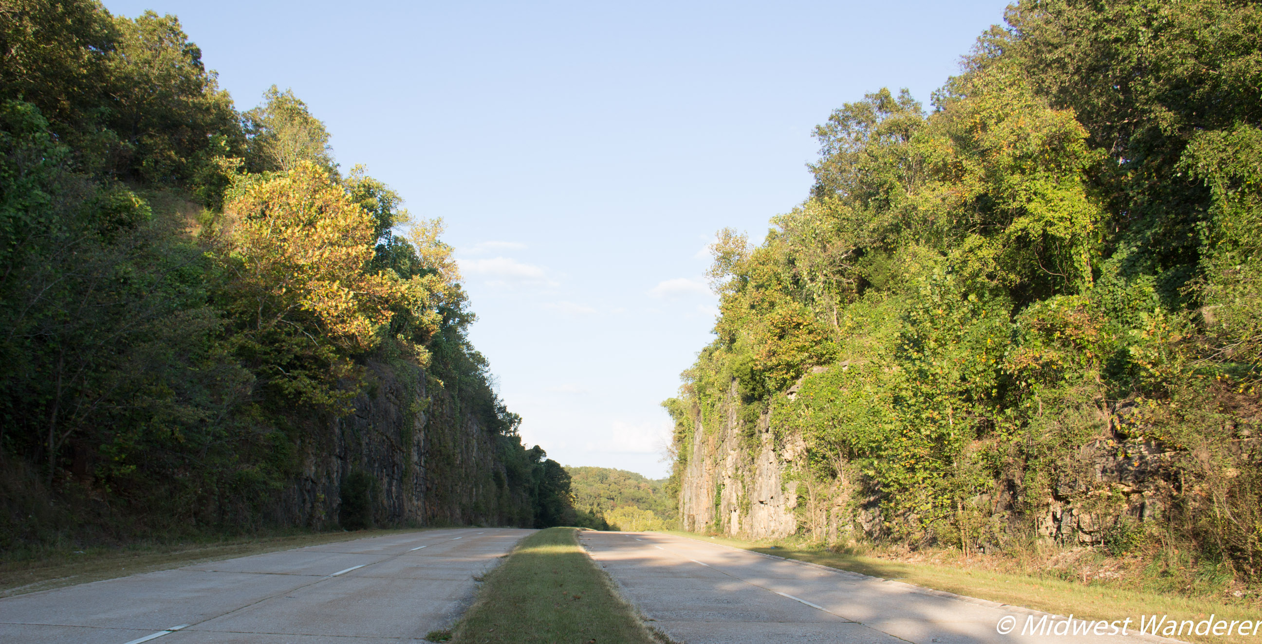
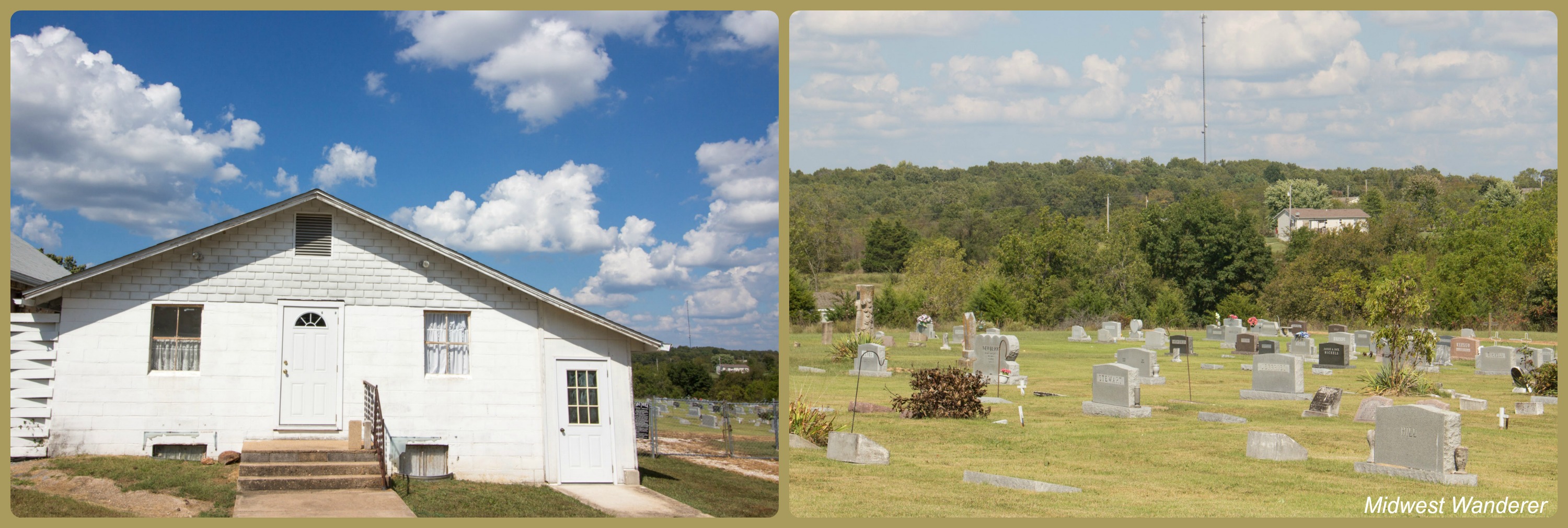
Our first stop was the Hooker Church and graveyard, which dates back to the early 1900s.At one time Hooker Cut was said to be the deepest road cut in the United States.
Side trip to Piney Beach Cabins
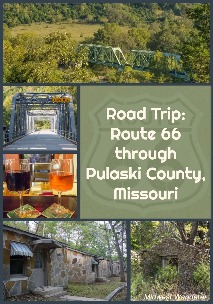
Following the auto tour guide, we turned off of Route 66 to head to the Piney Beach Cabins. The cabins are constructed of “giraffe rock.” We often see cabins and homes built of this rock throughout the Ozarks, but rarely anywhere else. Giraffe rock was apparently popular in 1940s construction. The cabins, which suffered damage in a spring “hundred year flood” are being restored.
Devil’s Elbow
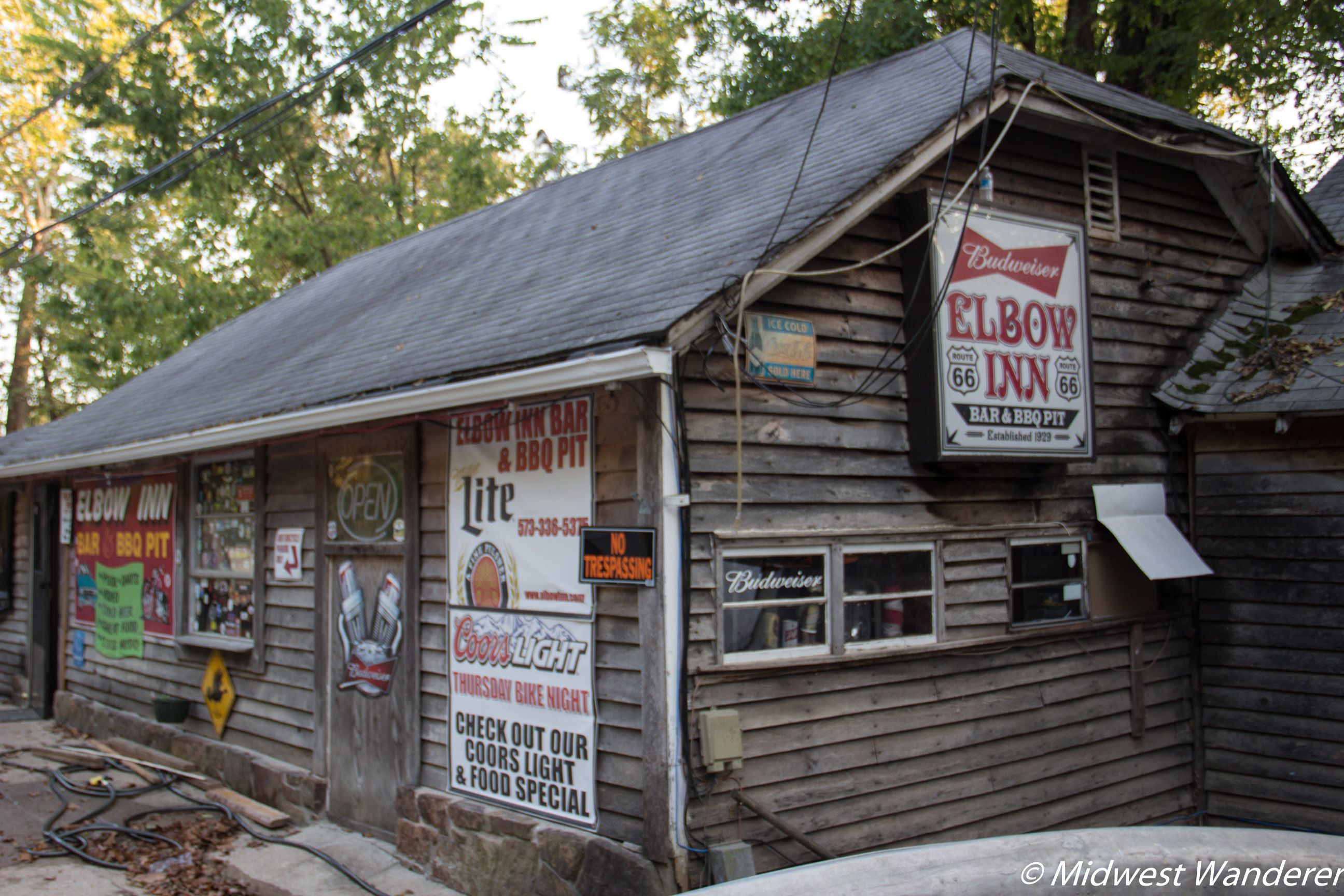
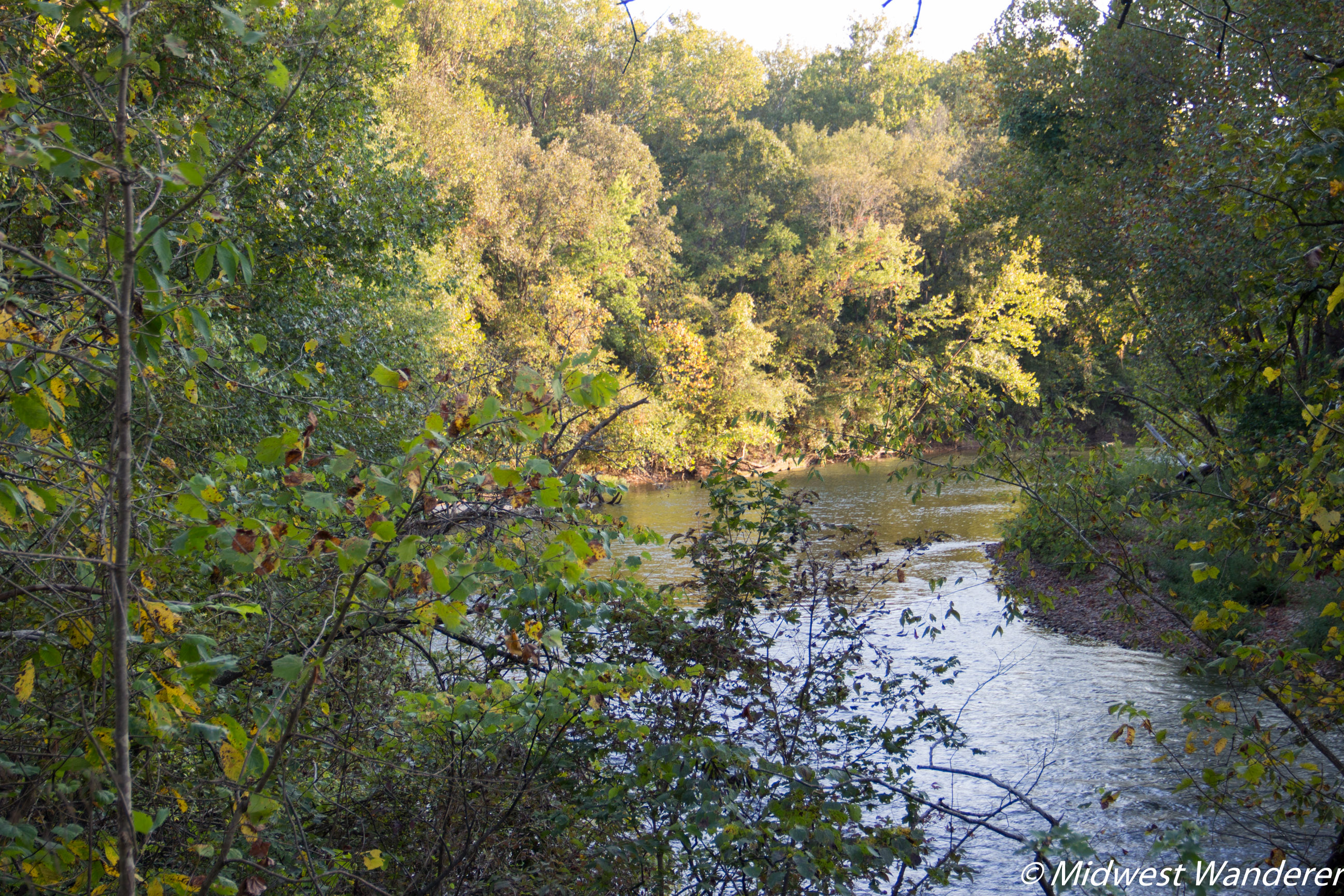
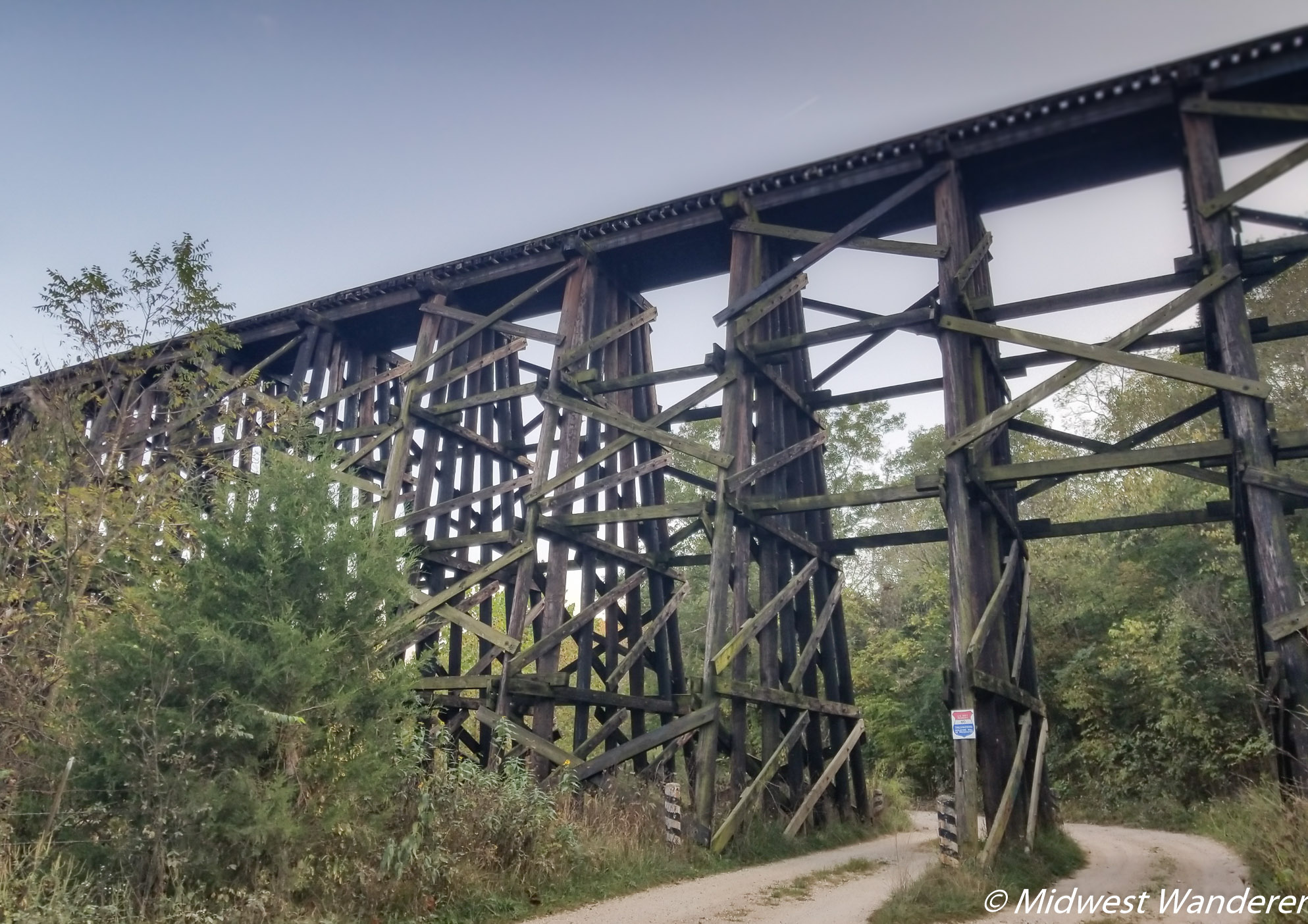
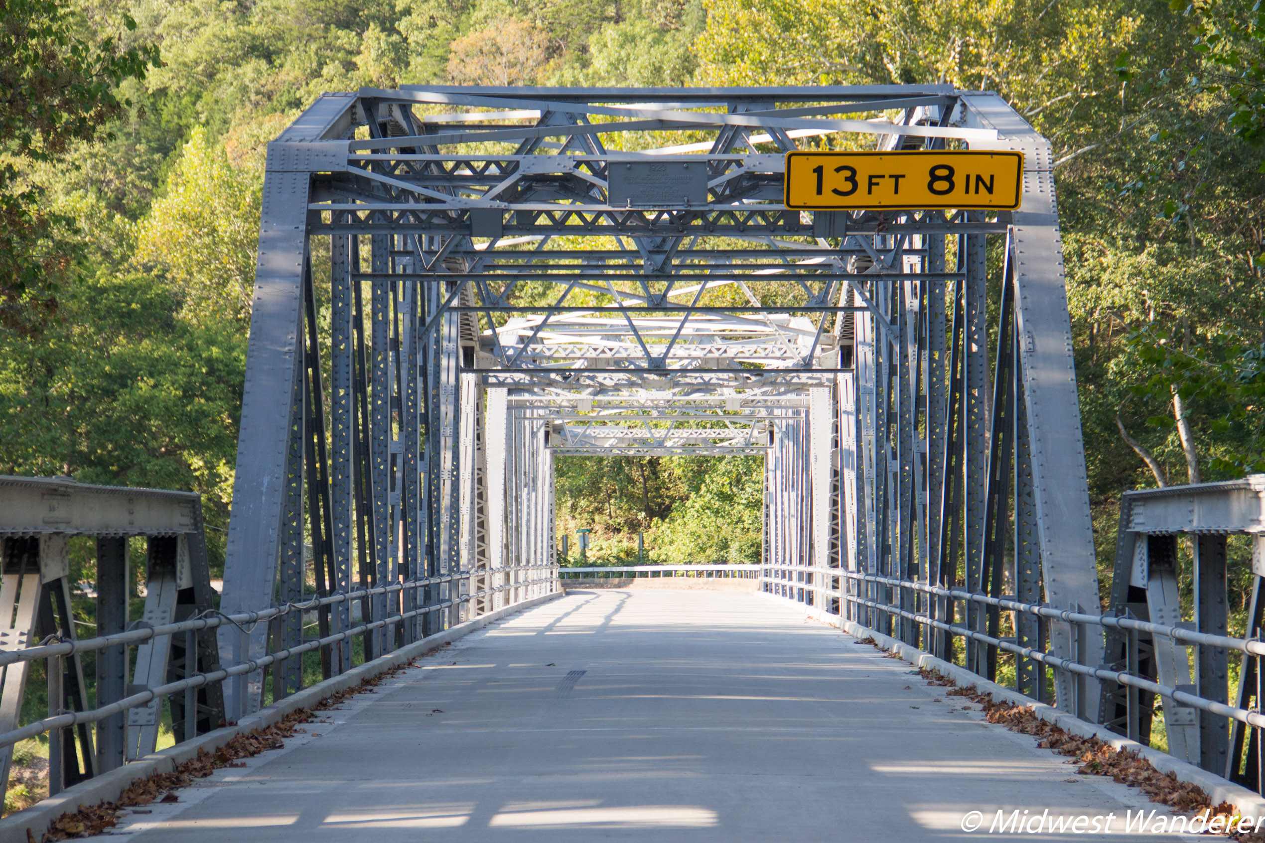
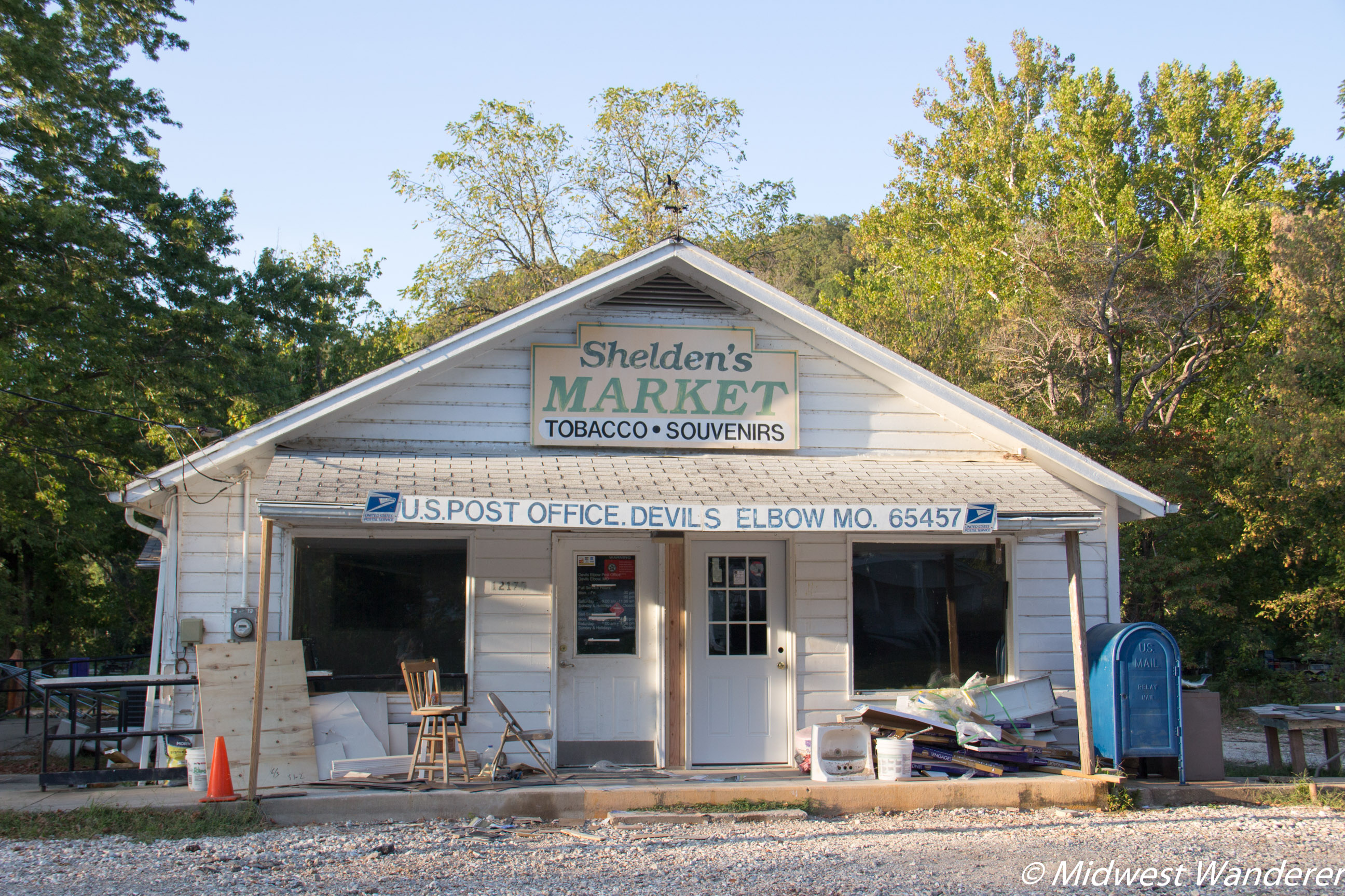
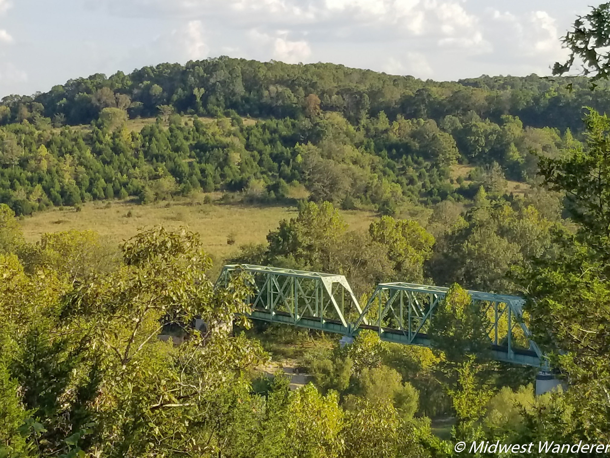
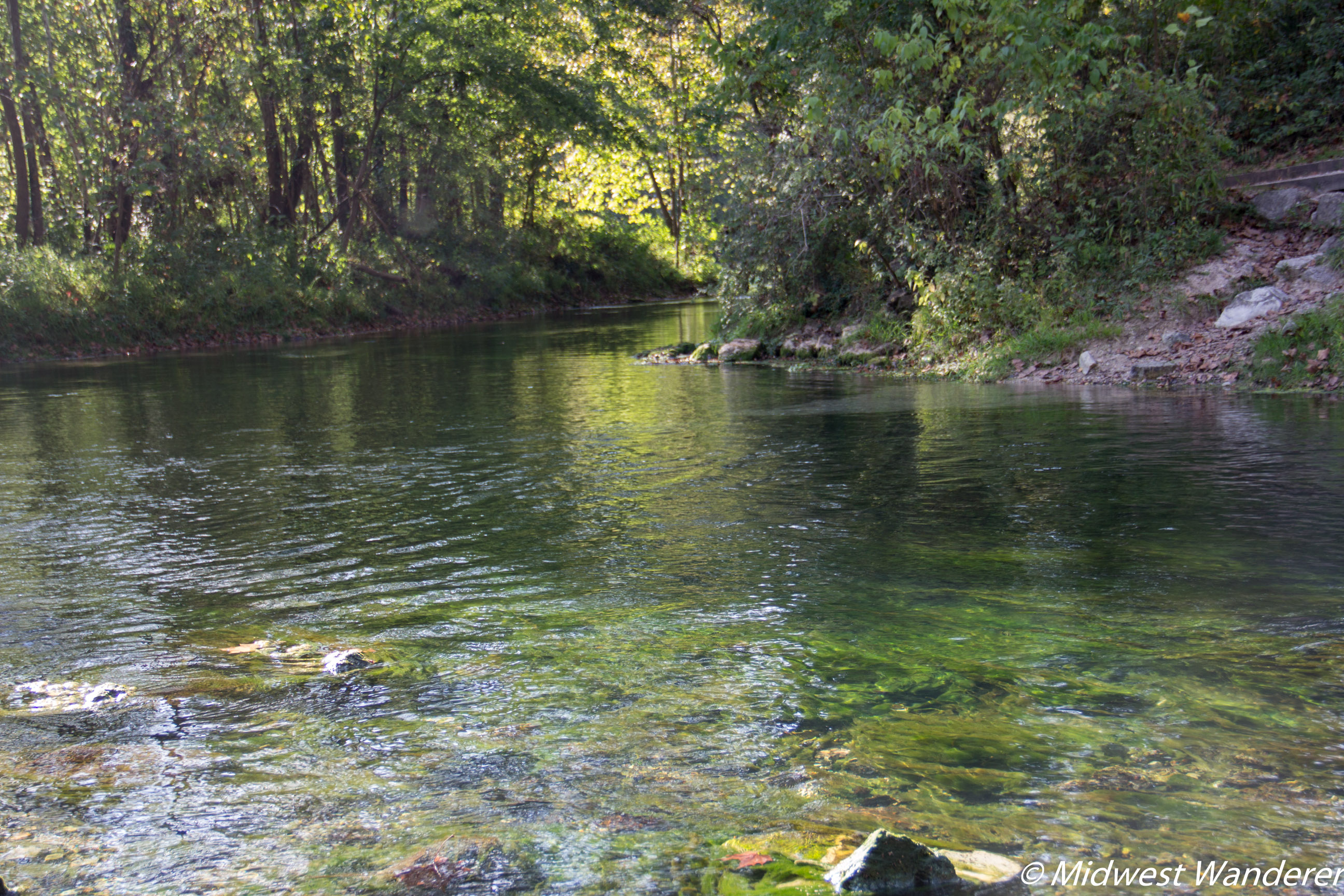
The Elbow Inn, located in the unincorporated community of Devil’s Elbow, also suffered damage in the spring flood but was open again when we visited in September.We turned off Route 66 onto Temporal Road to get a closeup look at the sharp bend in the Big Piney River. The bend and a large boulder lodged in the bend earned the area the name “Devil’s Elbow” by early loggers, as logjams often occurred here.The U.S. Army constructed this 40′ trestle bridge during the construction of Fort Leonard Wood in 1941.Back on Route 66, we crossed the Big Piney River on this 1923 steel truss bridge.Shelden’s Market and Post Office was also still recovering from the spring flood during our visit.A scenic overlook offers a gorgeous view of the valley at Devil’s Elbow.
Saint Robert
You may want to spend some time in Saint Robert. Saint Robert served as our base during our Pulaski County visit. The city offers many restaurant options, including several ethnic foods. We ate two meals here.
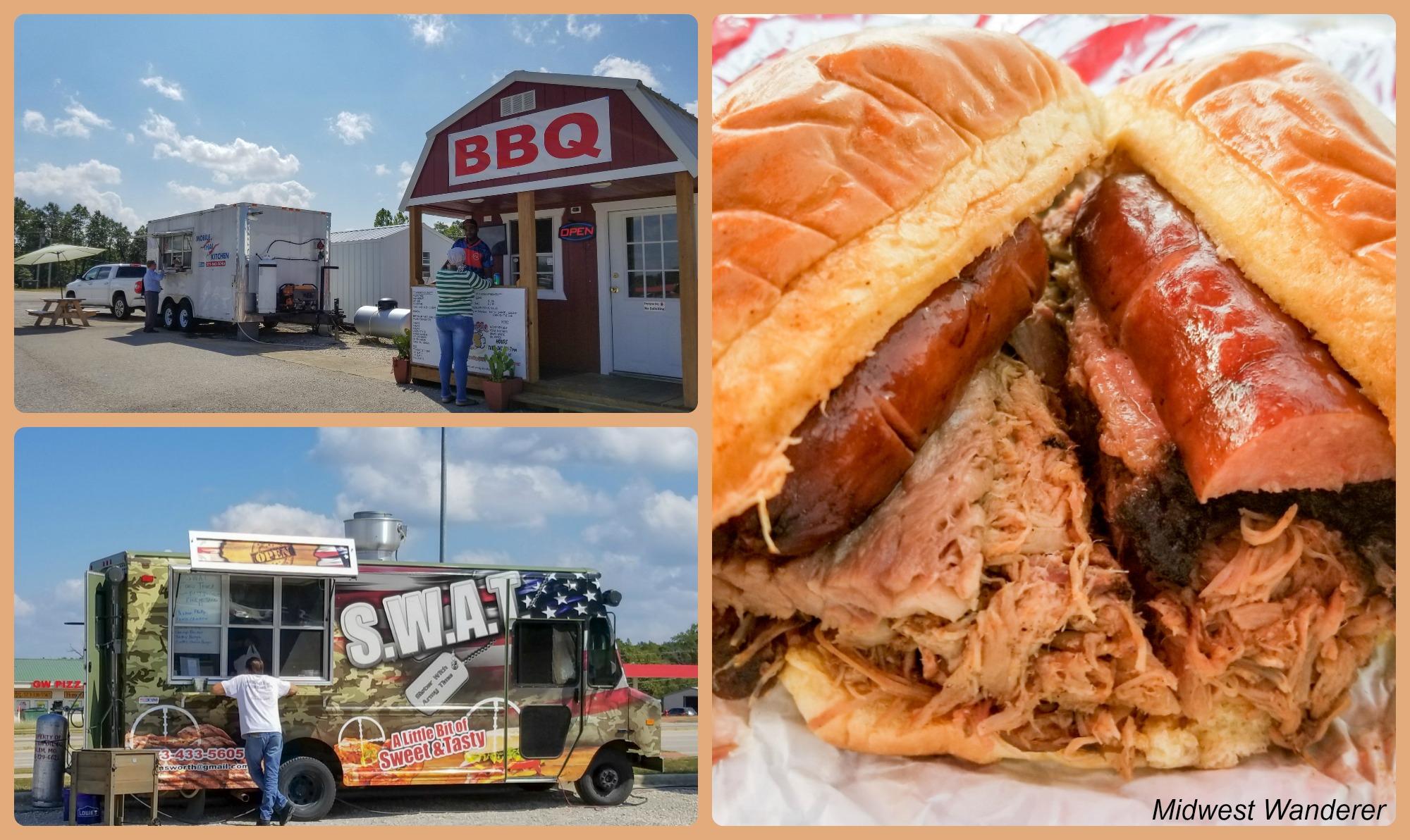
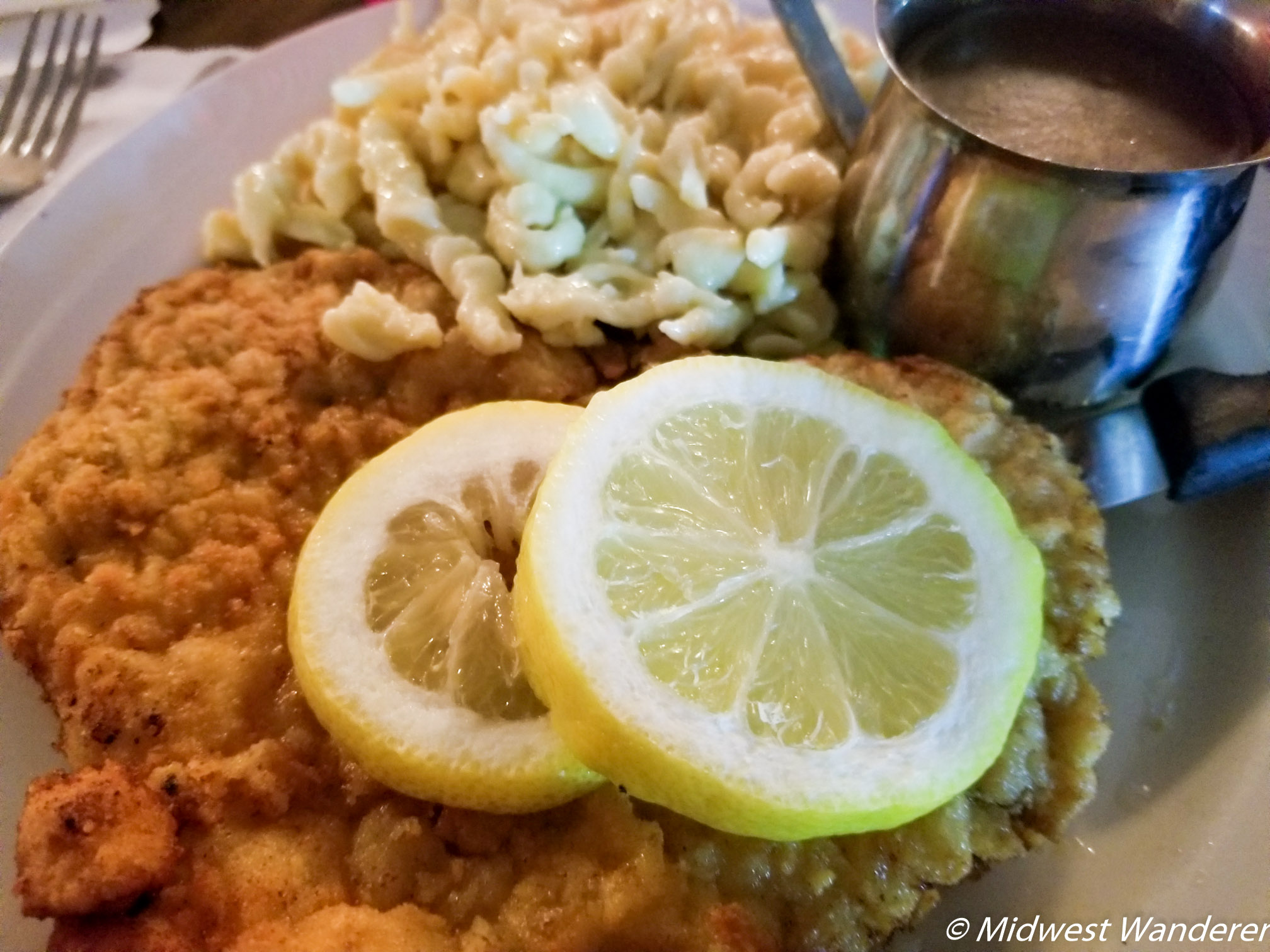
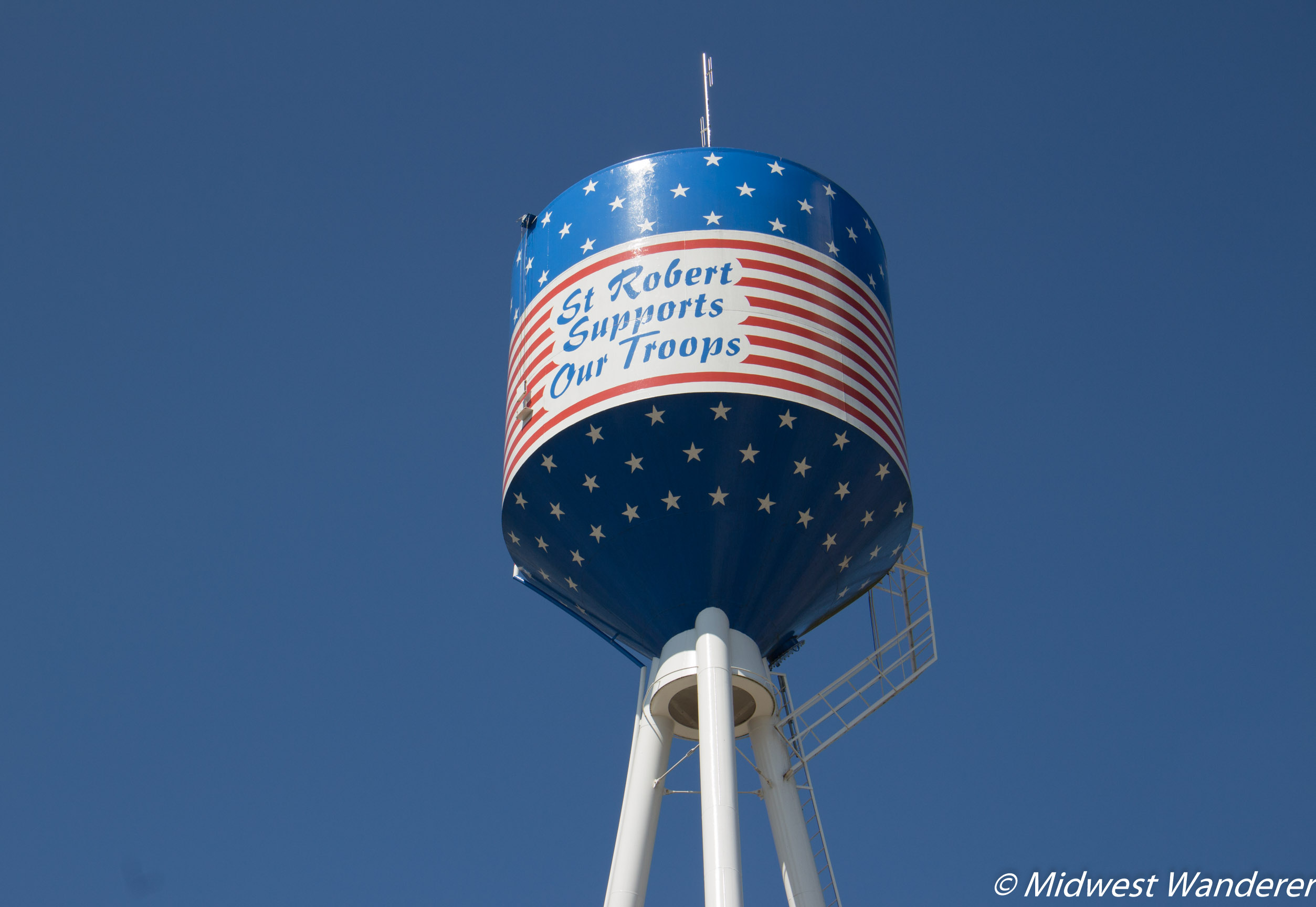
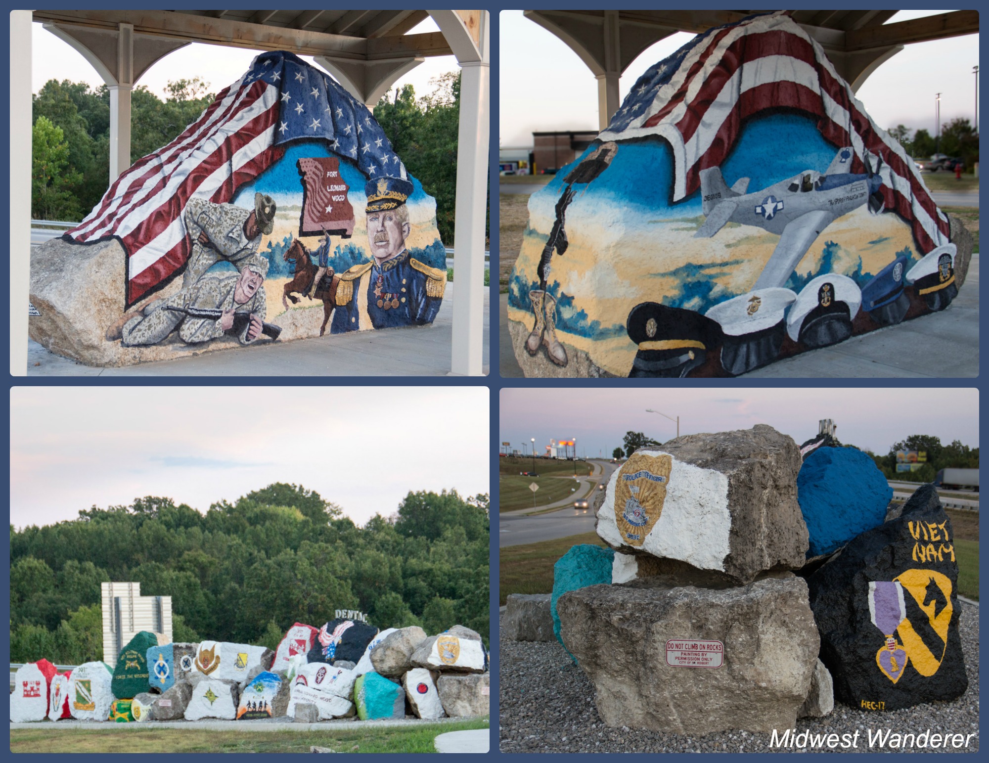
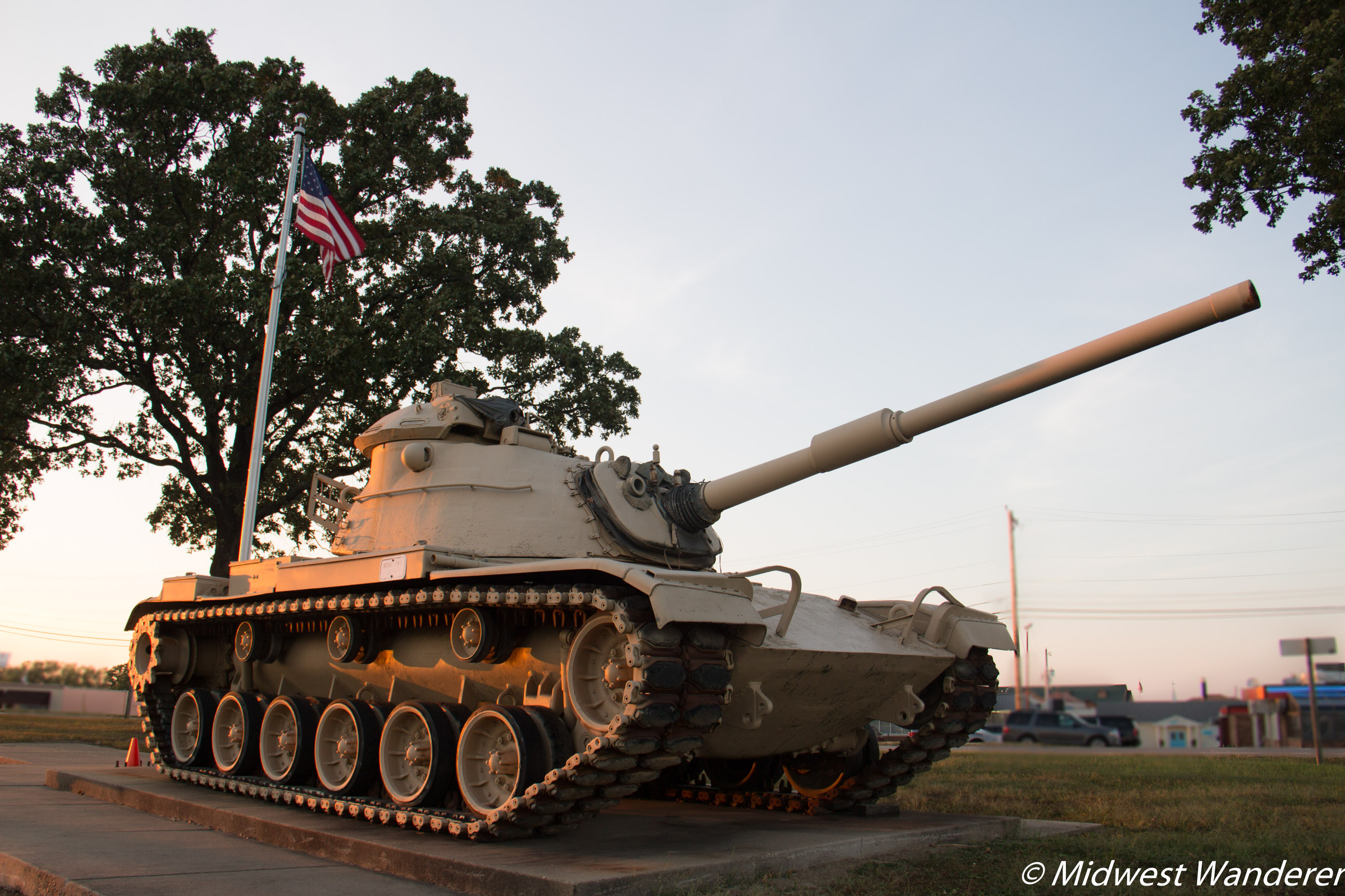
The Missouri Avenue Food Park gave us a choice of three options: S.W.A.T. for various sandwiches and soups; Mobile Thai Kitchen, and Brothers BBQ. We couldn’t pass up the HUGE Big Brother Sandwich, made up of pulled pork, beef brisket and a hot link. The sandwich is so large that it was plenty for us to split.One evening for dinner we dined at The Hub German Restaurant. The schnitzel was so large and the spaetzle so plentiful we took half of it with us and ate it for lunch the next day. We discovered it’s good cold, too!We originally snapped this photo because our young granddaughter likes to find water towers that are different, and we thought she’d enjoy this. However, our auto tour brochure explained there is significance to the three legs. Each leg points in the direction of one of the three rivers in Pulaski County: Big Piney, Gasconade, and Roubidoux.Saint Robert unveiled the city’s Freedom Rock (top photos) just weeks before our visit. Artist Ray “Bubba” Sorensen II painted the mural and plans to paint a Freedom Rock in each of the 50 states. The Freedom Rock joined existing Military Tribute rocks.A USMC M-60 Tank stands in George M. Reed Roadside Park.
Fort Leonard Wood
It isn’t surprising that Saint Robert has several military tributes, since Fort Leonard Wood is located only two miles away.
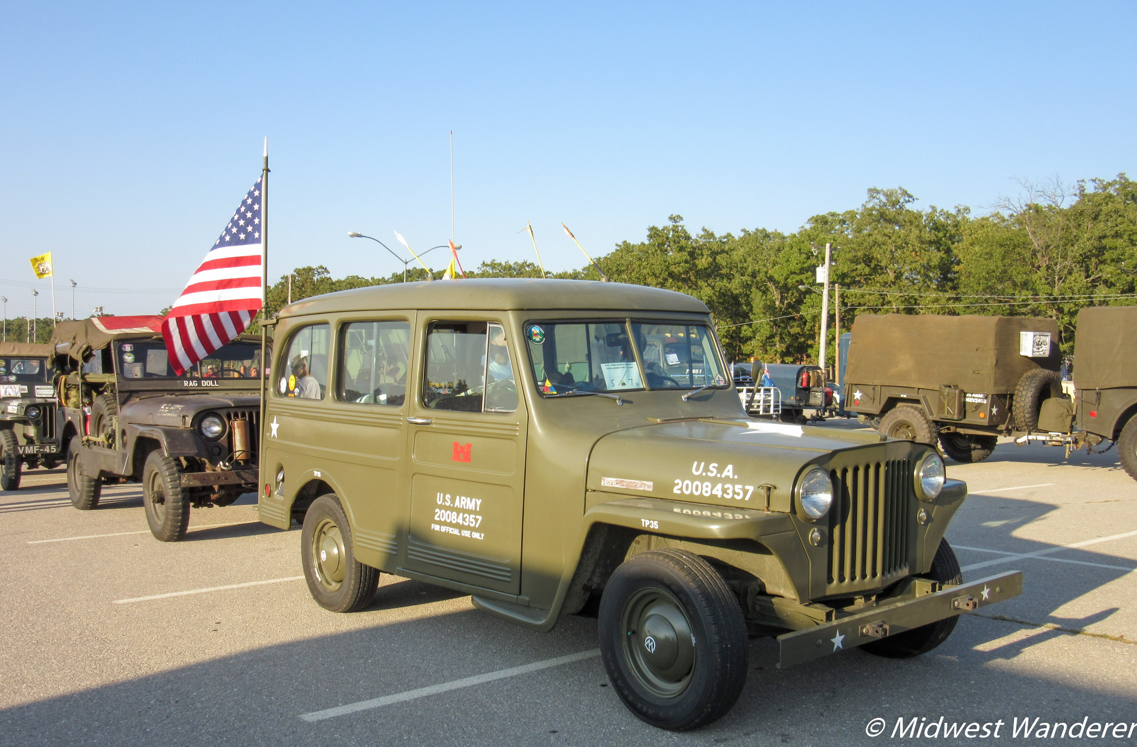
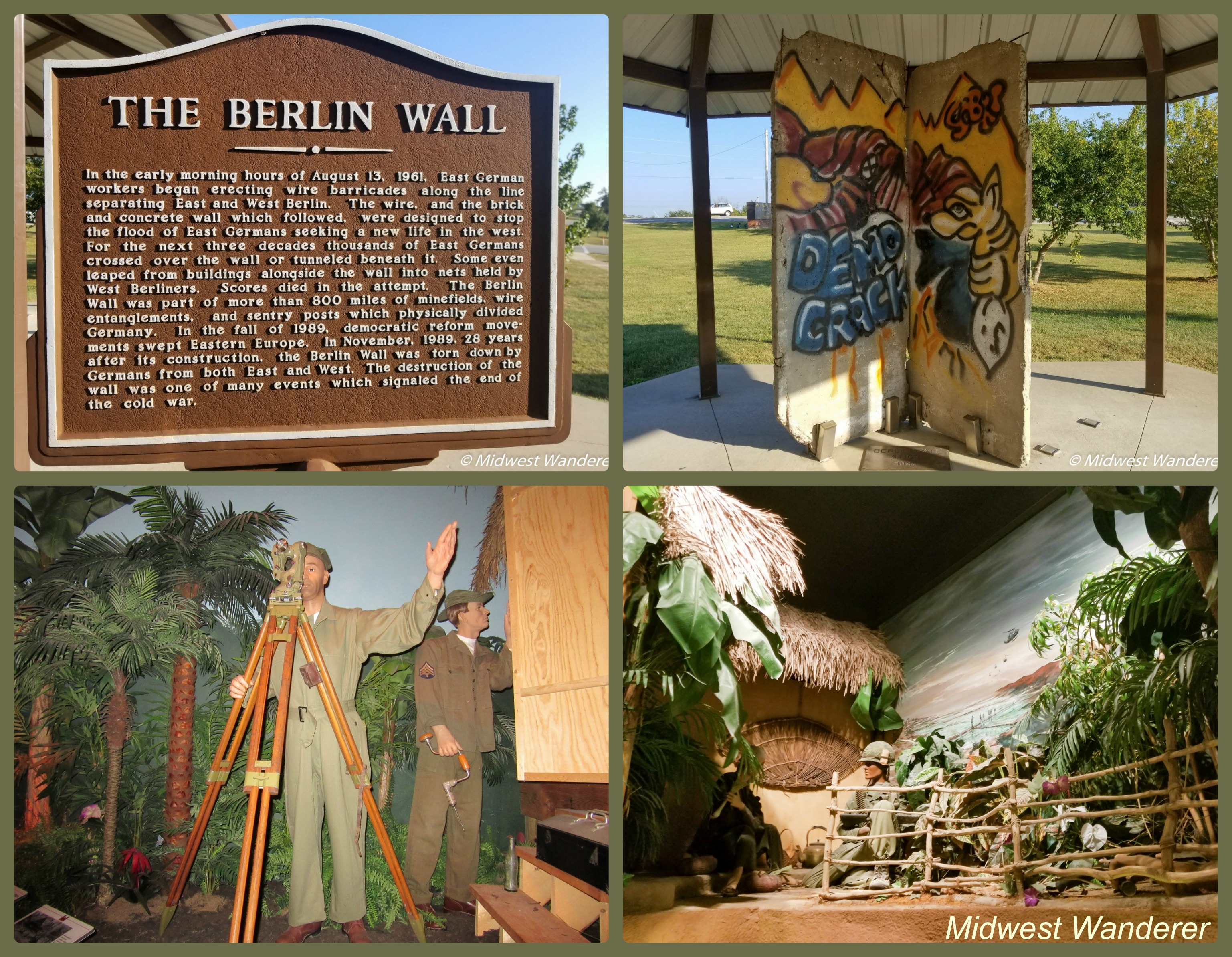
During our visit, an antique military vehicle convoy traveling Route 66 stopped at Fort Leonard Wood for an evening. The event was open to the public.While we were on the Army base, we toured the United States Army Engineer Museum.
Waynesville
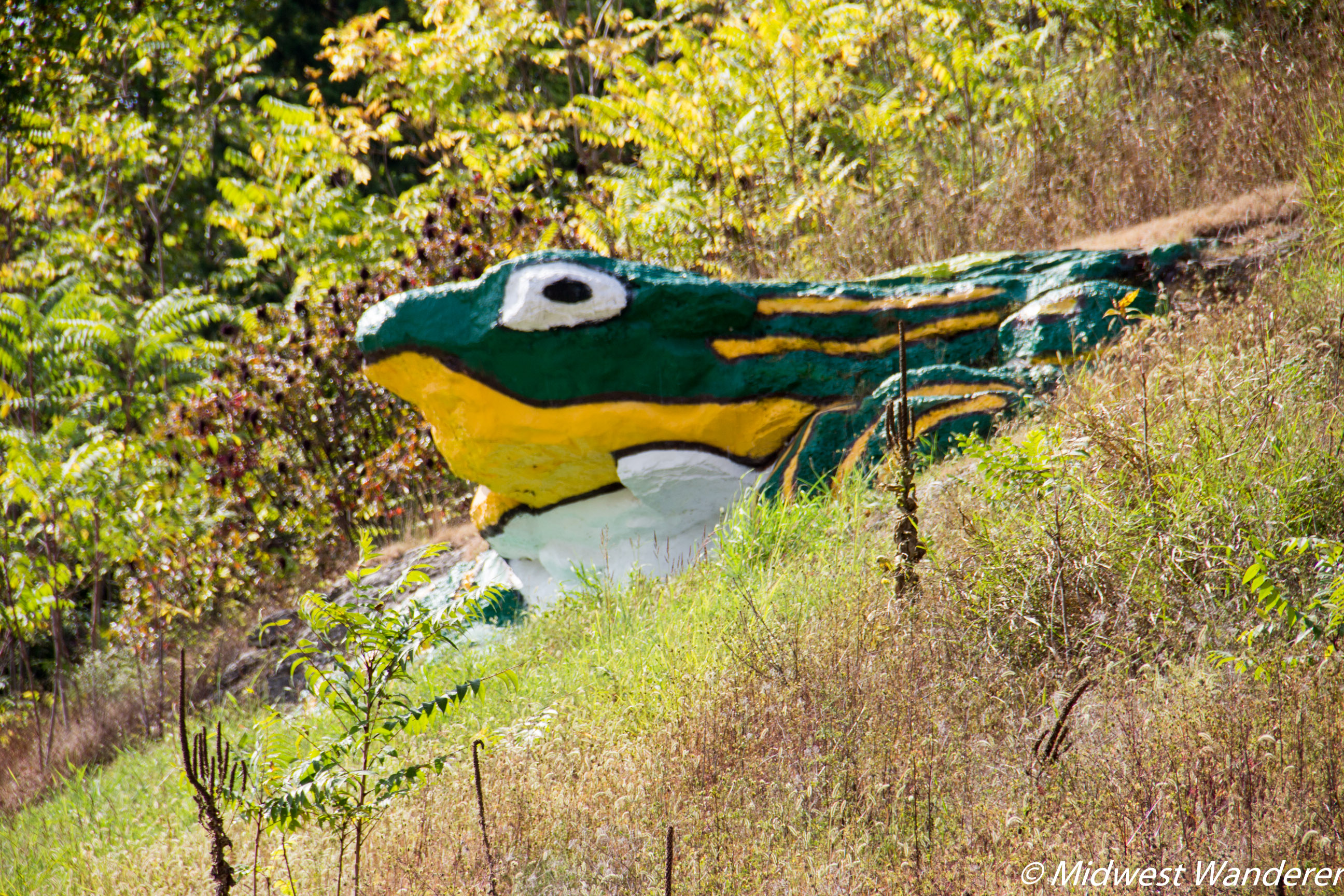
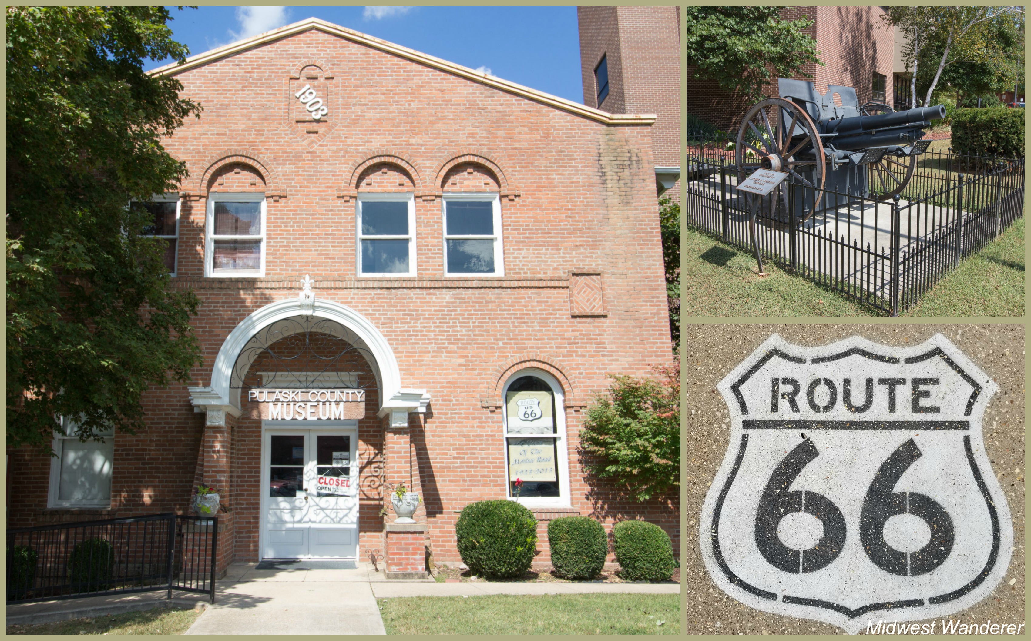
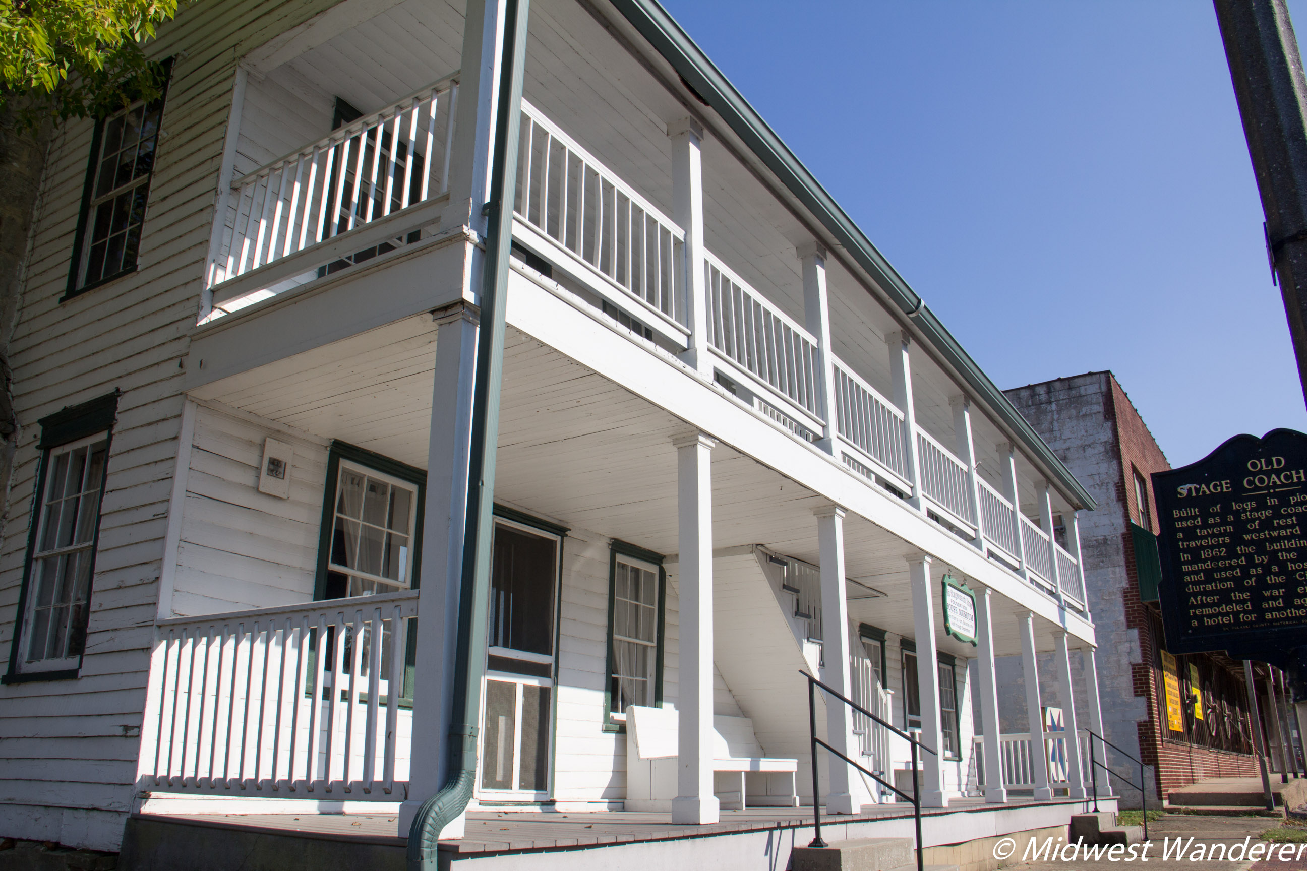
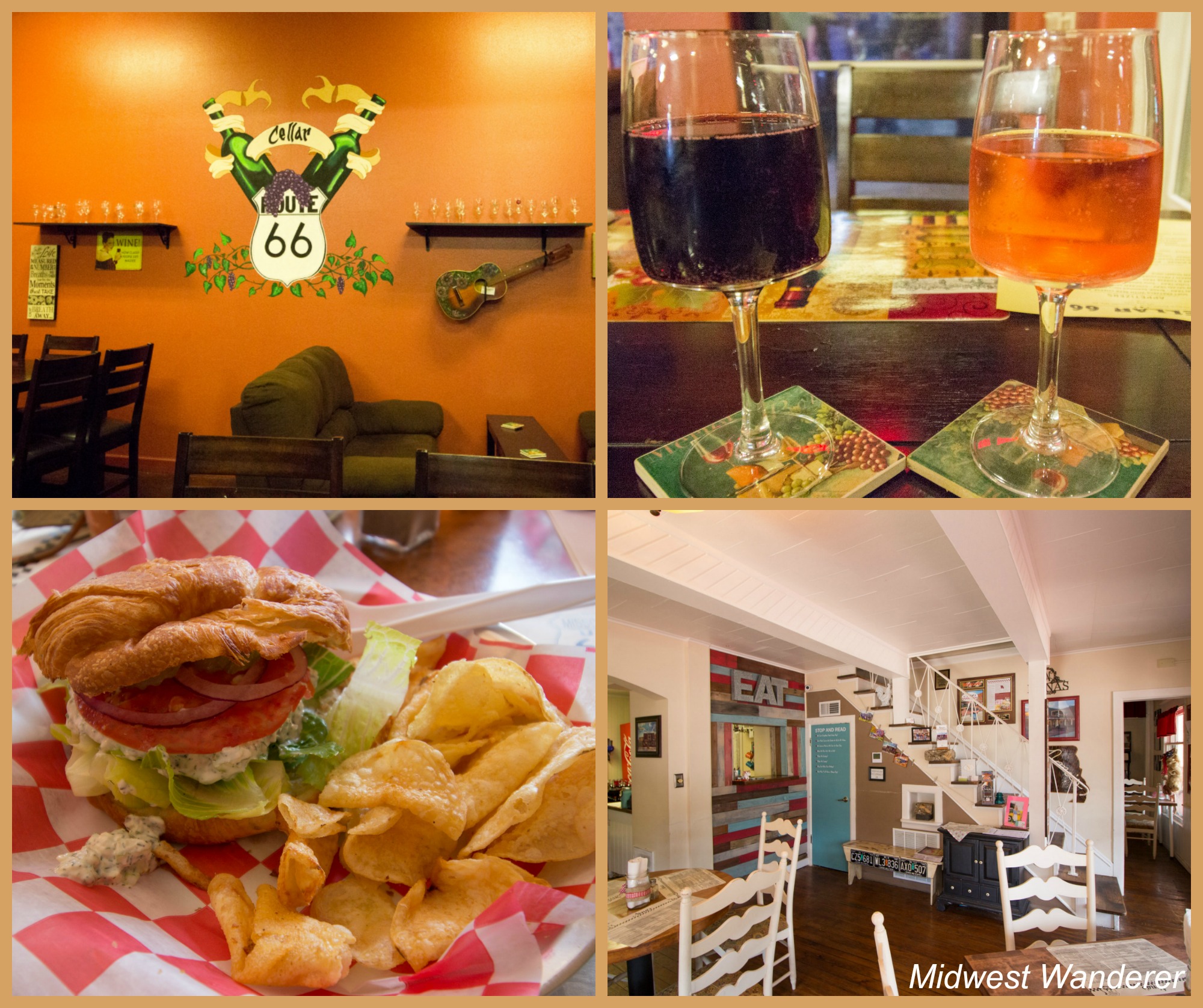
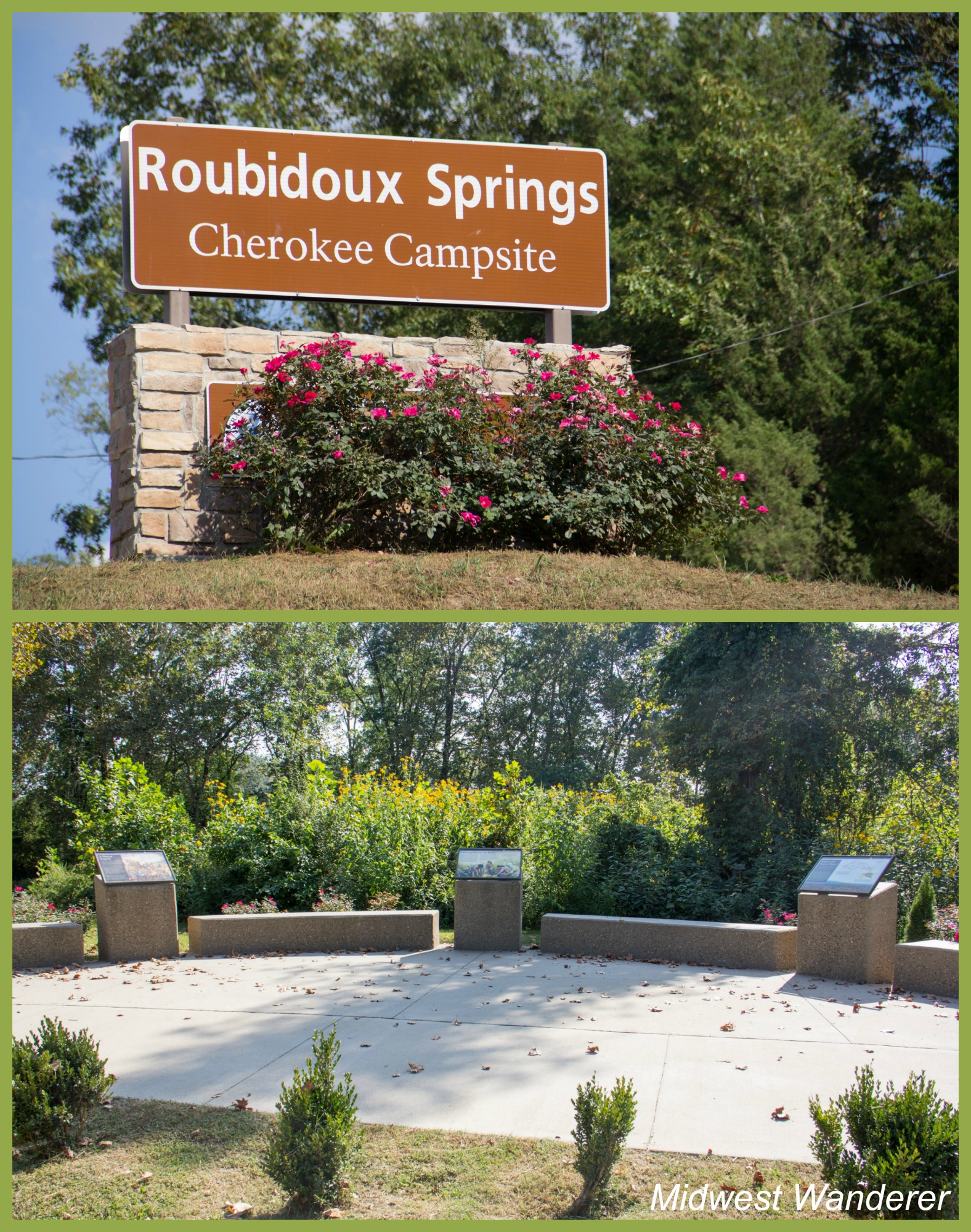
Back on Route 66 headed toward Waynesville, W. H. Croaker sits high on a hillside. (W. H. stands for Waynesville Hill.) A local tattoo artist painted the rock when residents noticed it resembles a frog. Fort Leonard Wood military groups maintain it.Waynesville is the Pulaski County seat. The old courthouse, built in 1903, now houses the Pulaski County museum. Unfortunately, the museum was closed during our visit.When you pick up your auto tour guide from the Pulaski County Visitors Center, be sure to also pick up a Waynesville Walking Tour guide to help you identify historic buildings in Waynesville, like the Old Stagecoach Stop, shown above.Take some time in Waynesville to browse shops or grab a bite to eat. We had a glass of wine and a burger one evening at Cellar 66. We also ate sandwiches for lunch at Nona’s Kitchen.Roubidoux Springs was the site of a Cherokee encampment during their forced migration from their homes in the east to Oklahoma. A Trail of Tears Memorial in Laughlin Park consists of several boards along a concrete path through the park.The spring water looked refreshing on the hot day we visited. In fact, a handful of swimmers were enjoying the cool, clear water.
Route 66 to the county line
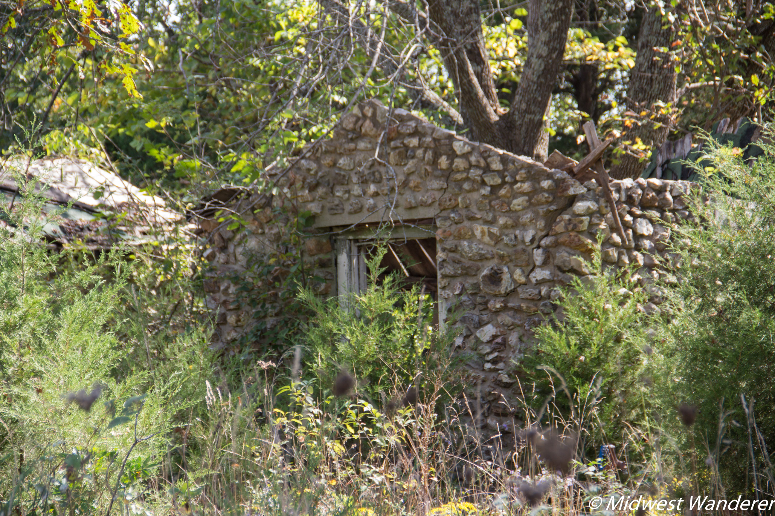
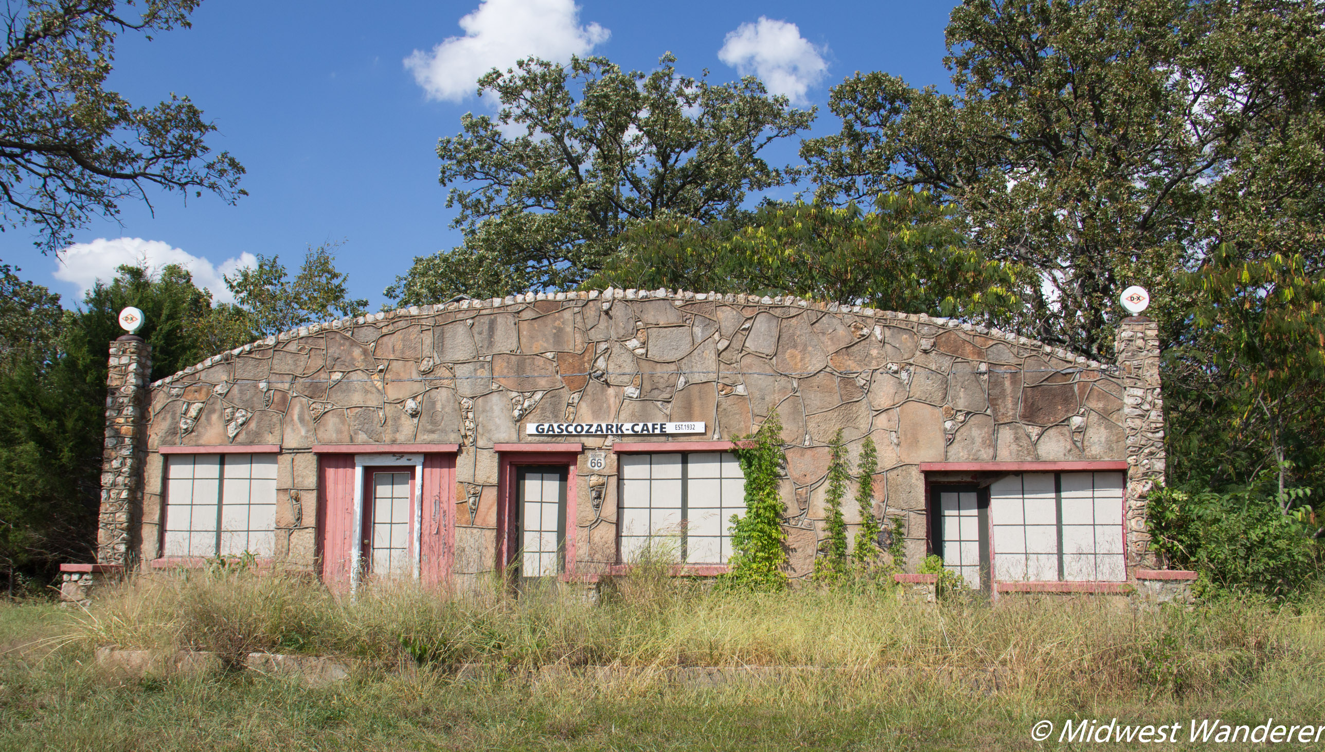
Idumea Church and graveyard. The first building was constructed in 1876. A more modern church building is adjacent.Spring Valley Court had four cabins and a shower house. Today, unfortunately, the buildings are crumbling and overgrown with weeds.Our last photo of Route 66 through Pulaski County was the former Gasozark Cafe.
If you take the Route 66 auto tour through Pulaski County
You can download the Historic Auto brochure here or pick up a copy at the Pulaski County Visitors Center located at 137 Saint Robert Boulevard in Saint Robert, Missouri.
Accomodations
We stayed at the Baymont Inn and Suite in Saint Robert during our visit to Pulaski County. Check rates here.
Pin It!
**********
Disclosures: The Pulaski County Tourism Bureau hosted our visit to the area. However, all opinions in this article are my own.
This article contains an affiliate link. If you book a room through the “Check rates here” link above, I will receive a small commission, at no additional cost to you.
Thank you for reading Midwest Wanderer. Don’t miss a post. Enter your e-mail address below and click Subscribe. I will notify youwhenever I publish another post. Subscription isFREE. After subscribing, be sure to click the link when you get the e-mail asking you to confirm.– Connie
My travel bucket list includes driving Route 66 (well, what’s left of it) from Illinois to California. This does such an amazing job of showing one slice of the experience!
Thank you! We have a couple of small stretches left that we somehow skipped over the years. We had planned to do it all at one time a couple of years ago, but to see everything would take at least three weeks.
There is literally SO much to see on Route 66! I done it in just under 3 weeks back in 2011, so had to skip parts! We stopped in Devil’s Elbow so saw the Elbow Inn and the steel bridge but I don’t remember seeing any of the other bits! Really interesting read!
You’re right that there is SO much to see on Route 66, especially when you get into some of the cities. You really could take months doing the route if you wanted to see and do everything.

How interesting I’ll have to get on Route 66 and head south!
Pulaski County does have some of the most scenic parts of Route 66 in the Midwest.
My travel bucket list includes driving Route 66 (well, what’s left of it) from Illinois to California. This does such an amazing job of showing one slice of the experience!
Thank you! We have a couple of small stretches left that we somehow skipped over the years. We had planned to do it all at one time a couple of years ago, but to see everything would take at least three weeks.
There is literally SO much to see on Route 66! I done it in just under 3 weeks back in 2011, so had to skip parts! We stopped in Devil’s Elbow so saw the Elbow Inn and the steel bridge but I don’t remember seeing any of the other bits! Really interesting read!
You’re right that there is SO much to see on Route 66, especially when you get into some of the cities. You really could take months doing the route if you wanted to see and do everything.